Maps Index
A list of Global port call destination maps
Venice
Get to know our slice of Paradise - located on the SW Coast of Fl.
Attractions
Beaches
Canoe/Kayak
Boat Launches
Boat Charters
Fishing Charter
Fishing Piers
Historical Sites
Golf
Parks
Hotels
Relocate
Venice Map
ports > maps > Europe
Maps of Europe
Europe makes up the western one fifth of the Eurasian landmass. It's
bounded by bodies of water on three sides: the Arctic Ocean to the north
(the Nordkapp
being its most northerly point), the Atlantic Ocean to the west and the
Mediterranean Sea to the south.
Europe's eastern borders are ill-defined and have been moving eastwards
throughout history. Currently, the Ural and Caucasus Mountains, the Caspian
and Black Seas and the Bosporus Strait are considered its eastern frontier,
making Istanbul the only metropolis in the world on two continents. Cyprus
is also considered a part of Europe.
Europe Destination Maps
Northern Europe Eastern and Central Europe Mediterranean
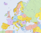 Europe 1 |
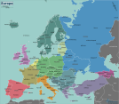 Europe 2 |
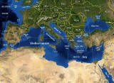
Mediterranean Sea |
Check the individual Europe port pages for the best selection of Europe maps and links.
Map Sources: USGS and World Fact book
